- You cannot add that amount to the basket — we have 1 in stock and you already have 1 in your basket. View basket
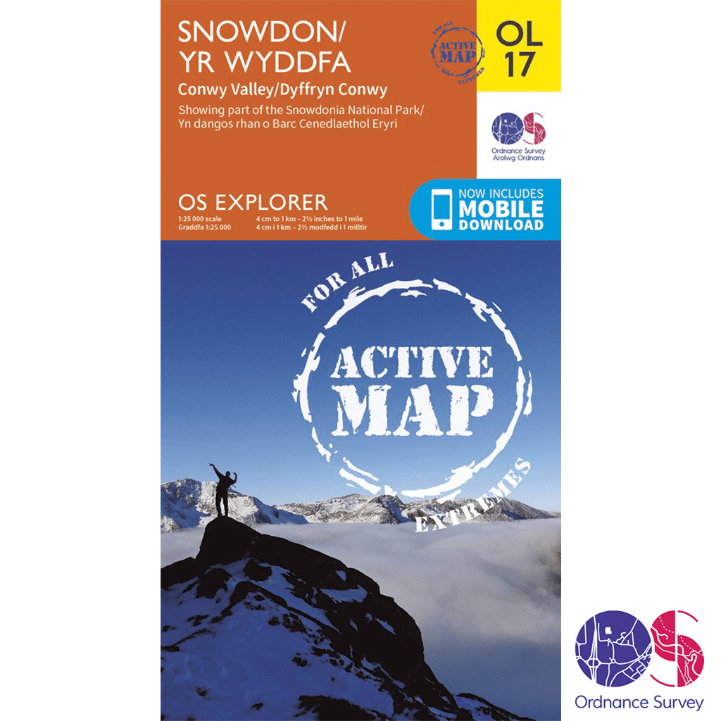
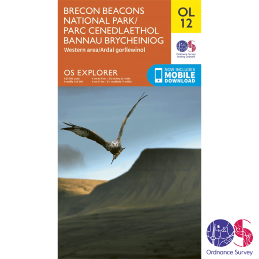
Ordnance Survey Explorer Active – OL 17 – Snowdon
£14.99

Ordnance Survey Explorer Active – OL 17 – Snowdon in the OS Explorer map series is the ideal map for exploring the mountain scenery in Snowdon. This area, famous for its fantastic walking routes, is home to the highest mountain in Wales. Take one of the six well mapped routes to the summit of Mount Snowdon and enjoy the views!
2 in stock
Description
Ordnance Survey Explorer Active – OL 17 – Snowdon
Explorer – 1:25 000 scale (4 cm to 1 km 2.5 inches to 1 mile)
The essential map for outdoor activities
The OS Explorer Map is the Ordnance Surveys most detailed folding map and is recommended for anyone enjoying outdoor activities including walking, horse riding and off-road cycling. Providing complete GB coverage, the OS Explorer map series details information essential in the great outdoors, including youth hostels, pubs and visitor information. Rights of way, fences, permissive paths and bridleways are clearly shown, ensuring you have the best information to get the most out of your time in the countryside.
You can now discover the landscape in all weathers thanks to OS Explorer Map Active, a tough, versatile version of the OS Explorer map.
OL 17 – Snowdon
Walks, trails and paths
- North Wales Path
- Isle of Anglesey Coastal Path (Llwybr Arfordirol)
Areas and Locations
- Anglesey (Ynys Mon)
- Bangor
- Betws-y-coed
- Caernarfon
- Conwy
- Llandudno
- Snowdonia National Park
- Gwynedd
- Clwyd
Snowdon has the perfect mountain form, with textbook glacial corries and knife-edged aretes. Snowdon has big paths, which can get overcrowded in summer, but when you turn your back on the new cafe complex and look across the horizon of a hundred hills you’ll know why you came.
The view from the summit shows the difference between the north and south faces of the range. Y Lliwedd’s north face is hung with cliffs and gullies, but in contrast the south faces of Carnedd Ugain and Crib Goch are pallid and barren, consisting of dusty pink screes and broken rock.
Snowdon is at its most rugged when its’ flanks coincide with the top of the Llanberis Pass. Here, huge glaciers, which were slow to melt on the shady side of the mountain, scoured out the gorge, leaving a devastation of boulders and severe precipices which must have struck fear into the early traveller.
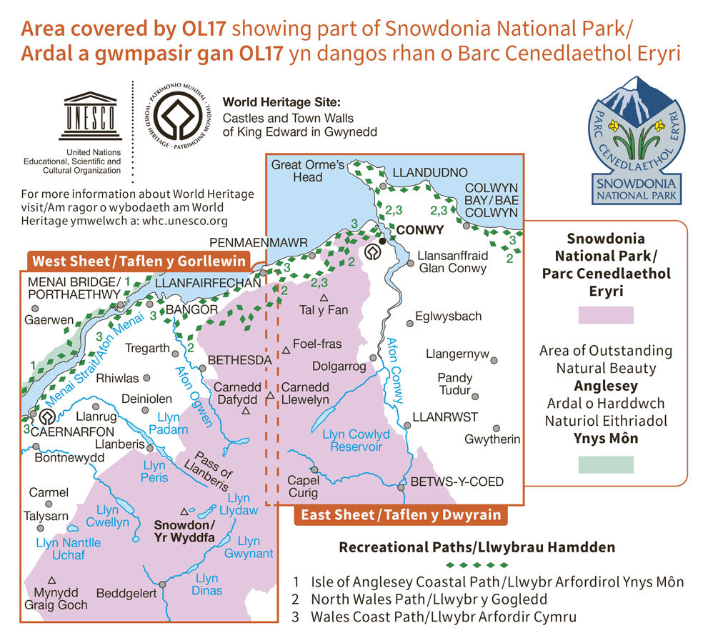
Highlights: Snowdon (Yr Wyddfa), Llanberis Path, Conwy, The Menai Strait and Colwyn Bay, Llandudno, Beddgelert, Conwy, Bethesda, Betws-y-Coed, Bangor and Caernarfon. Also includes other popular landscape features in the Snowdonia range such as Carnedd Llewelyn, Carnedd Dayfydd, Glyder Fawr, Glyder Fach, Tal y Fan and Tryfan.
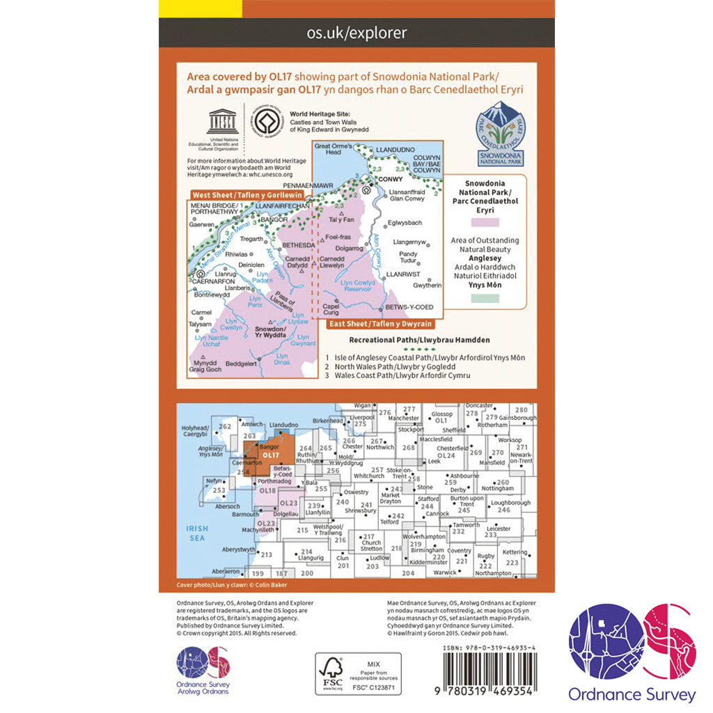
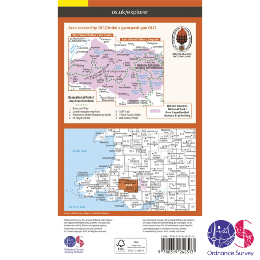
Ordnance Survey Explorer Active – OL 17 Mapping Area
How to access the digital version of this map
This map comes with a digital version which you can download to your smartphone or tablet.
Go to OS.uk/redeem for more details (terms and conditions apply).
Scratch off the panel on the inside cover of the map to reveal a code, you are then just three easy steps away from downloading your digital map. If the scratch panel has already been scratched off or if you have any problems downloading your map, please call the OS Customer Service Centre on 03456 050505.
Additional information
| Brand | |
|---|---|
| Continent | |
| Country | Wales |
| County | |
| Location Keywords | Anglesey (Betws-y-coed), Bangor, Betws-y-coed, Caernarfon, Conwy, Llandudno |
| Map Number | |
| Map Title | |
| National Park | |
| Pack | |
| Product Category | |
| Trail Keywords | Isle of Anglesey Coastal Path (Llwybr Arfordirol), North Wales Path |
Delivery Information
Shipping is free on all orders for our UK customers!
Orders will be processed and shipped as quickly as possible, however, we are experiencing delays at the moment.
Once your order has been processed it will be shipped by Royal Mail’s 24 or Tracked 24 Service, which delivers Monday to Saturday. Larger or heavier orders are then shipped by DHL.
Orders under £50 will be sent by the Royal Mail 24 Service, which delivers within 48 hours of despatch. Orders over £35 will be sent by the Royal Mail Tracked 24 Service, which delivers within 24 hours of despatch, and any orders over £100 will require a signature.
You will receive a Royal Mail or DHL Tracking Number once your order has been processed.
To avoid disappointment, please contact us if you require the items urgently.
Please don’t hesitate to contact us if you have any questions about delivery.
International Orders
We currently charge £15 for all orders for customers outside of the UK.
Return an Item
Free “No Fuss” Tracked Returns!
Not happy with the product? Item doesn’t fit? Or did we send the wrong item? No problem, we’ll get that sorted for you!
Step 1
Package the unwanted items up, ready to send back.
Step 2
Click the button below to produce a Royal Mail Pre-paid Returns sticker, making sure to include your order number.
You will also be emailed a QR code that you can take to the Post Office, so they can produce your sticker – should you not have a printer.
Step 3
Take the package to your nearest Post Office.
We will then be notified by Royal Mail that you are returning something.
Step 4
We will check the package in when it arrives with us and arrange your refund as quickly as possible. This is usually within 1 working day of the item arriving back. You will then get an email confirming that the refund has happened and you should receive your refund either back to your card or PayPal account within 24-48 hours. If you have any questions or concerns, please get in touch.
Related products
-
 Recommended Retail Price: £130.00
-
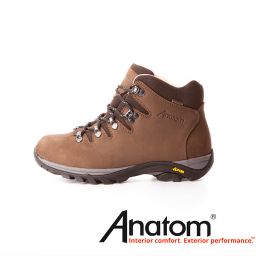
Anatom Q2 Ultralight Women’s Hiking Boots
- £114.75
- Select options This product has multiple variants. The options may be chosen on the product page
-
Reviews
There are no reviews yet.