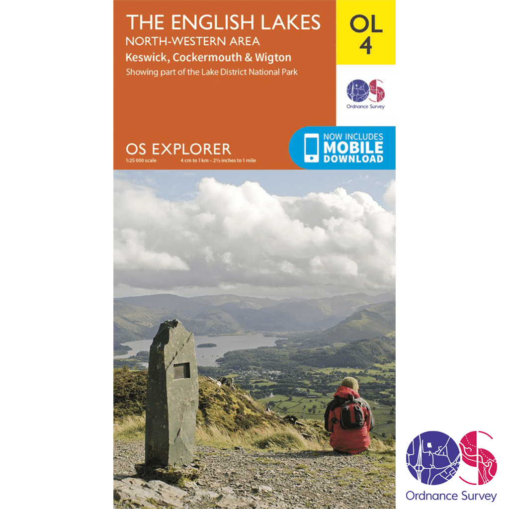
Ordnance Survey Explorer – OL 4 – English Lakes NW
£8.99

Ordnance Survey Explorer – OL 4 in the OS Explorer map series, The English Lakes: North-western area, is the ideal map for exploring the north-west area of the Lake District. This area is home to many natural and man made attractions from oval hills shaped by glaciers to stunning views over majestic lakes.
Out of stock
Description
Ordnance Survey Explorer – OL 4 – English Lakes NW
Explorer – 1:25 000 scale (4 cm to 1 km 2.5 inches to 1 mile)
The essential map for outdoor activities
The OS Explorer Map is the Ordnance Surveys most detailed folding map and is recommended for anyone enjoying outdoor activities including walking, horse riding and off-road cycling. Providing complete GB coverage, the OS Explorer map series details information essential in the great outdoors, including youth hostels, pubs and visitor information. Rights of way, fences, permissive paths and bridleways are clearly shown, ensuring you have the best information to get the most out of your time in the countryside.
We recommend the use of a Map Case to enjoy this map in all conditions, or alternatively have a look at the OS Explorer Active range of maps.
OL 4 – English Lakes NW features
Walks, trails and paths
- Allerdale Ramble
- Cumbria Way (Guide Book)
- Cumbria Coastal Way
Areas and Locations
- Keswick
- Cumbria
- Lake District National Park
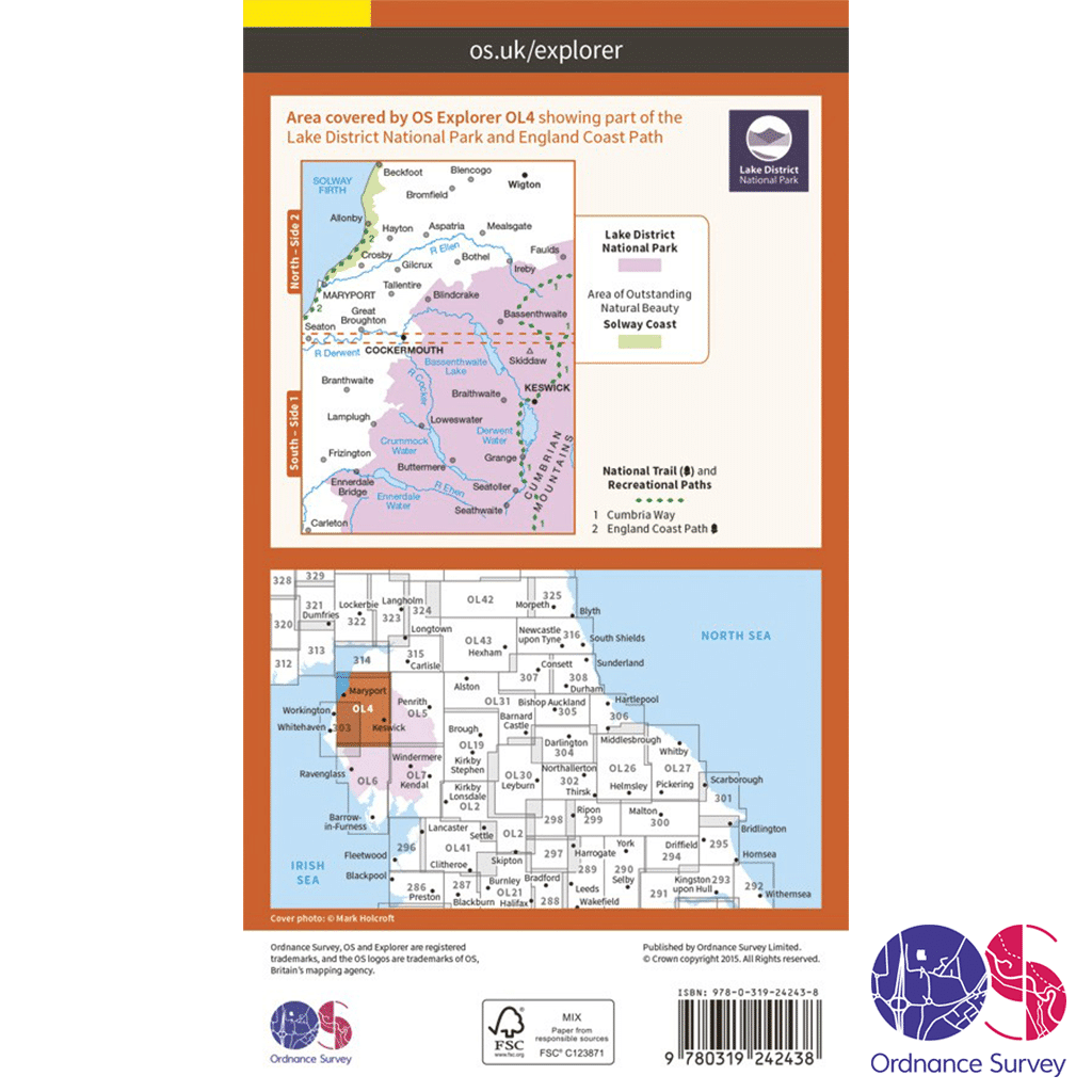
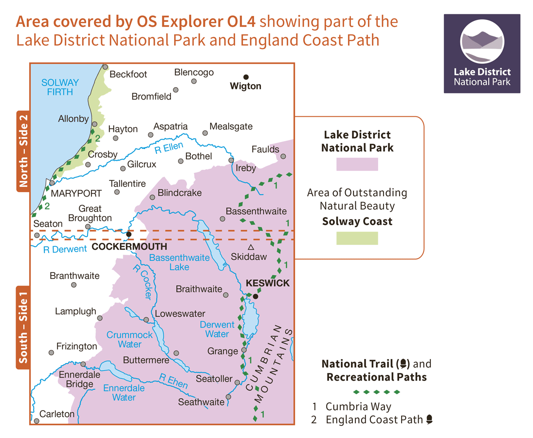
With the Ordnance Survey Explorer – OL 4 – English Lakes NW map it couldn’t be easier to find your way around the North West Lake District. From Wigton to Carleton, this carefully crafted map is your essential guide for exploring a stunning area of the English Lakes. Whether you’re outward bound on two wheels or two feet, you’ll have no problem navigating your way along the lake shores, and up and down the fells.
Follow the Allerdale Ramble, the Cumbrian Coastal Way or the Cumbrian Way, stopping off to take in a collection of spectacular sites and beautiful scenery, all carefully marked and easy to find on the map. Take a trip to the open air theatre in the grounds of Mirehouse, on the edge of beautiful Bassenthwaite Lake – a spot that inspired both Tennyson and Wordsworth.
Admire the views of Derwent Water from atop Catbells fells if you’re more energetically inclined. And if you’re looking for a challenge, standing at 3,054 ft above sea level, Skiddaw provides an easy in-road to mountain climbing, for occasional walkers looking to push their boundaries.
Whatever your outdoor interests, from climbing to kayaking, with every landmark, house, river, viewpoint, hill, right of way and pub covered, you’ll definitely be on the right track with the OS Explorer map of the North West Lake District to hand.
Highlights: Keswick, Derwent Water, Bassenthwaite Lake, Buttermere, Crummock Water and Ennerdale Water, Skiddaw, Pillar, Haystacks, Green Gable, Great Gable, Catbells, the Cumbrian Way, Braithwaite, Stonethwaite and Seathwaite.
Ordnance Survey Explorer – OL 4 Mapping Area
How to access the digital version of this map
This map comes with a digital version which you can download to your smartphone or tablet.
Go to OS.uk/redeem for more details (terms and conditions apply).
Scratch off the panel on the inside cover of the map to reveal a code, you are then just three easy steps away from downloading your digital map. If the scratch panel has already been scratched off or if you have any problems downloading your map, please call the OS Customer Service Centre on 03456 050505.
Additional information
| Brand | |
|---|---|
| Continent | |
| Country | England |
| County | |
| Location Keywords | Keswick |
| Map Number | |
| Map Title | |
| National Park | |
| Pack | |
| Product Category | |
| Trail Keywords | Allerdale Ramble, Cumbria Coastal Way, Cumbria Way (Guide Book) |
Delivery Information
Shipping is free on all orders for our UK customers!
Orders will be processed and shipped as quickly as possible, however, we are experiencing delays at the moment.
Once your order has been processed it will be shipped by Royal Mail’s 24 or Tracked 24 Service, which delivers Monday to Saturday. Larger or heavier orders are then shipped by DHL.
Orders under £50 will be sent by the Royal Mail 24 Service, which delivers within 48 hours of despatch. Orders over £35 will be sent by the Royal Mail Tracked 24 Service, which delivers within 24 hours of despatch, and any orders over £100 will require a signature.
You will receive a Royal Mail or DHL Tracking Number once your order has been processed.
To avoid disappointment, please contact us if you require the items urgently.
Please don’t hesitate to contact us if you have any questions about delivery.
International Orders
We currently charge £15 for all orders for customers outside of the UK.
Return an Item
Free “No Fuss” Tracked Returns!
Not happy with the product? Item doesn’t fit? Or did we send the wrong item? No problem, we’ll get that sorted for you!
Step 1
Package the unwanted items up, ready to send back.
Step 2
Click the button below to produce a Royal Mail Pre-paid Returns sticker, making sure to include your order number.
You will also be emailed a QR code that you can take to the Post Office, so they can produce your sticker – should you not have a printer.
Step 3
Take the package to your nearest Post Office.
We will then be notified by Royal Mail that you are returning something.
Step 4
We will check the package in when it arrives with us and arrange your refund as quickly as possible. This is usually within 1 working day of the item arriving back. You will then get an email confirming that the refund has happened and you should receive your refund either back to your card or PayPal account within 24-48 hours. If you have any questions or concerns, please get in touch.


Reviews
There are no reviews yet.